 |
TEDBURY CAMP QUARRYA geological gem inthe Mendip Hills |
Site description and interpretation
An increasing level of interest in Tedbury Camp has developed over the last few years, prompted by regular visits from students attending the nearby East Mendip Study Centre, trainee Science teachers and university undergraduate field trips. The site is also a popular destination for geological societies and interested members of the public, particularly since it features in Farrant’s (2008) walkers’ guide to eastern Mendip.
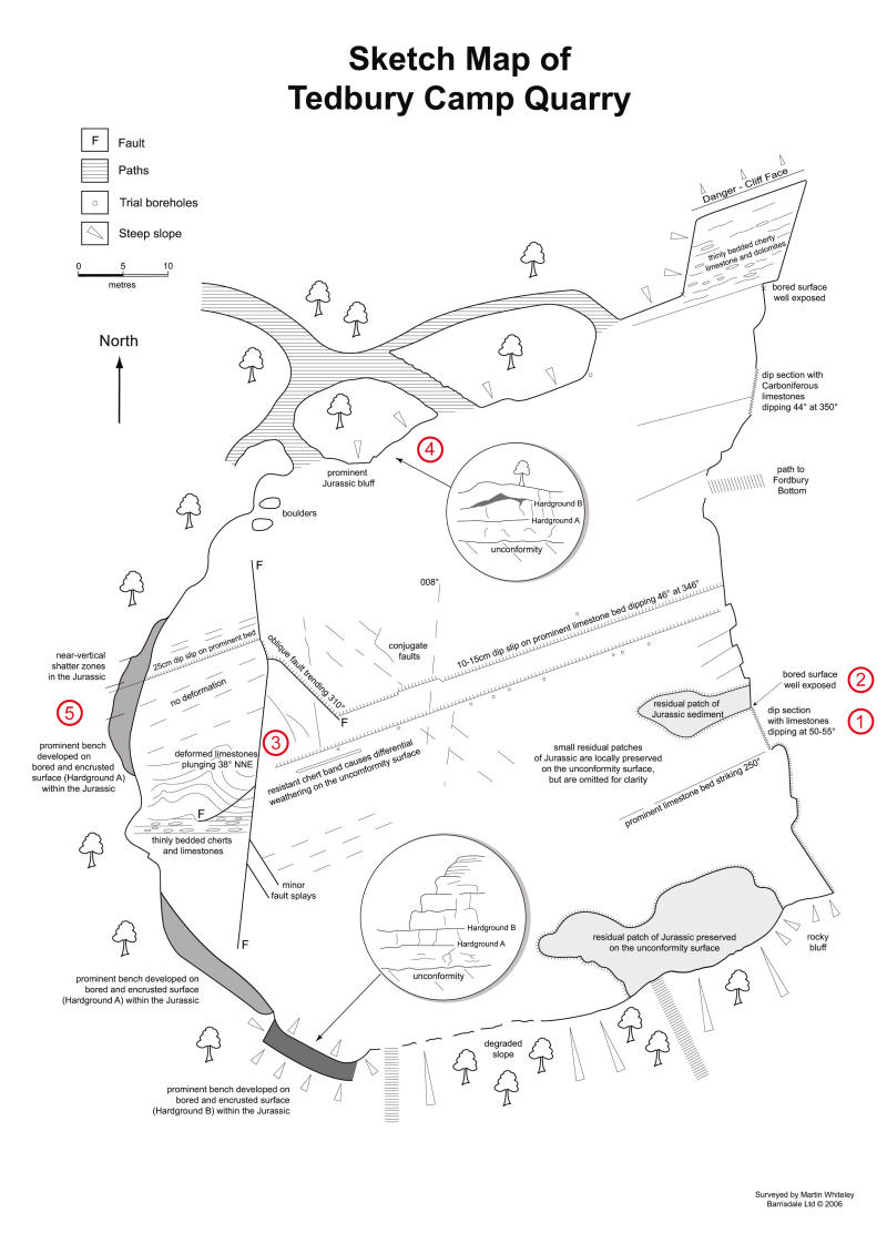
One aim of this website is to provide a detailed map of Tedbury Camp Quarry (Figure 5). This resulted from a survey undertaken in 2006 and it illustrates the major geological features evident at that time. The map is complemented by seven annotated sketches produced using PicturesToExe software. These resources can be used as the basis for an informed visit, without having to spend a good deal of preparatory time on a reconnaissance trip and gathering background information.
|
Figure 5. Sketch map of Tedbury Camp Quarry. The locations of five annotated sketches are shown in red numbers (1-5), whilst the other two sketches are panoramic views across the quarry |
It is anticipated that visitors to Tedbury Camp will have their own agenda, be it a 10-minute overview, a detailed examination, a guided tour or a research project. This website does therefore not provide specific teaching aids or learning outcomes, although some of the material may prove useful for those purposes. For those who wish to develop a structured approach to fieldwork, there is an excellent discussion in Earth Heritage Conservation (Wilson, 1994; Chapter 3.3) that deals with geological observations, sketches, note-taking, deduction and synthesis, all based on this site.
![]()